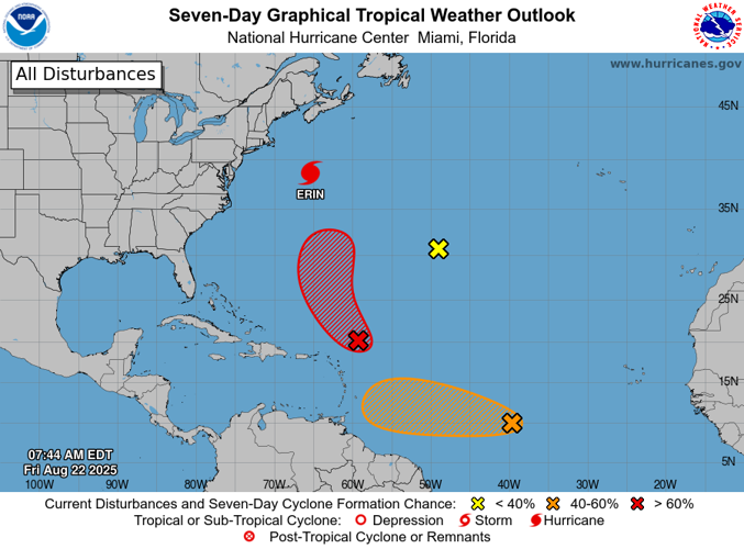
A tropical wave drifting in the Atlantic that hurricane forecasters have tracked for days could become the next named tropical storm over the weekend, according to the National Hurricane Center.
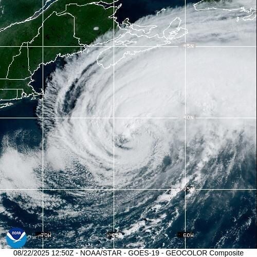
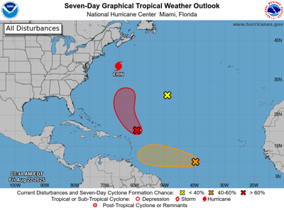
The disturbance is one of three areas forecasters were tracking as of Friday morning in addition to Hurricane Erin, the once formidable storm that has since weakened to a Category 1 hurricane. Erin is expected to weaken into a post-tropical storm in the coming days.
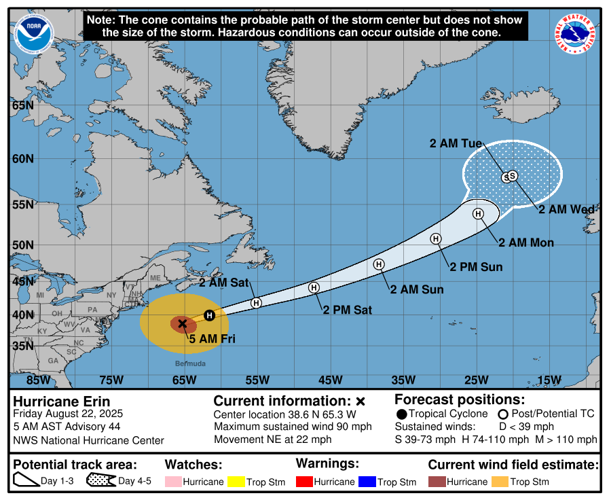
Despite weakening, Erin will continue to produce life-threatening rip currents in the Eastern U.S., Atlantic Canada and the Bahamas for the next few days as it continues to move north.

Disturbance 1
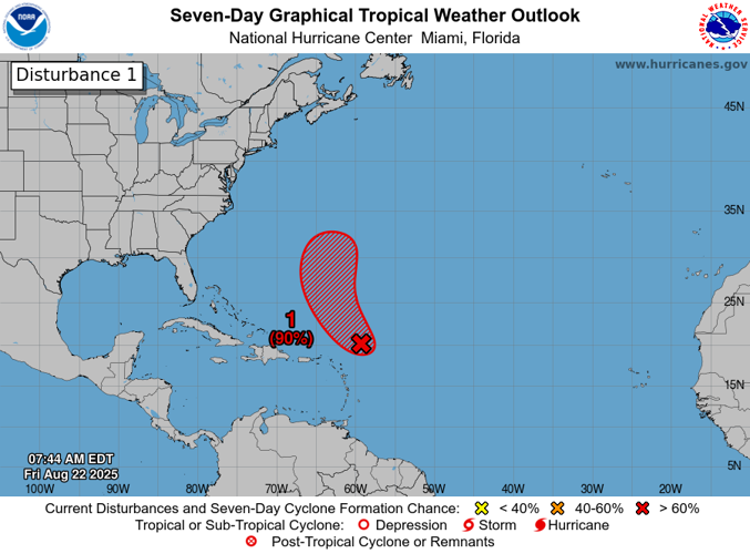
A tropical wave, currently located about 100 miles east-northeast of the northern Leeward Islands, appeared to be roughly following Erin's path, moving northwest and eventually north, NHC forecasters said. The system has an 80% chance of forming within the next 48 hours and a 90% chance of forming within the next week.
Louisiana State Climatologist Jay Grymes said Friday morning that the wave is likely to become Tropical Storm Fernand.
The system will likely be in between the northern Leeward Islands and Bermuda when it forms this weekend, forecasters said, and it is not expected to affect Louisiana.

Hurricane Erin
The first hurricane of the 2025 Atlantic season was still producing life-threatening surf and rip currents and as it was set to begin its post-tropical transition, forecasters said.
The latest forecast showed Erin becoming post-tropical within the next day, meteorologists said.
While Louisiana is not at risk, Erin closed beaches throughout the East Coast and forecasters warn that swimming in these beaches will remain unsafe for a few more days. Coastal flooding is expected during high tide along the Mid-Atlantic and New England coasts through Friday night and tropical storm-force wind gusts are also possible in southeast Massachusetts.
Erin was 425 miles south southwest of Halifax as of 7 a.m. Friday and was producing maximum sustained winds of 90 mph as it moved northeast at 22 mph.

Disturbance 2
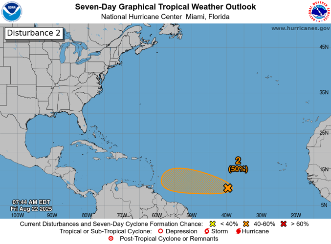
Another tropical wave between Africa and the Windward Islands had a moderate chance of development as it moves west toward the Lesser Antilles, Grymes said.
NHC forecasters said it is possible the system could form into a short-lived tropical depression to form with the next day, but it is expected to move to a less friendly environment Saturday.

Still, the wave could end up in a slightly more favorable environment late this weekend into early next week as it moves toward the Lesser Antilles.
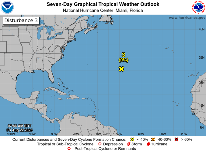
Disturbance 3
The last system hurricane forecasters were tracking Friday was a small area of low pressure southwest of the Azores.
Forecasters initially highlighted the storm Thursday and said the system showing no signs of development in the next few days after it weakened overnight. It is expected to drift northward.


